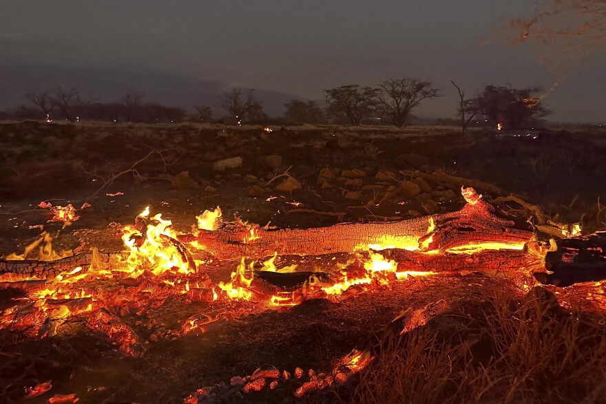
Hawaii is known for its breathtaking landscapes, stunning beaches, and vibrant culture. However, like many places, it can face natural disasters, including wildfires. In this article, we will explore the concept of the Hawaii fire map, its importance, how to read it, and what steps you can take to stay safe. Whether you’re a resident or a visitor, knowing about fire safety and prevention can make a big difference.
What is a Fire Map?
A fire map is a visual tool that shows areas affected by wildfires. It provides information about current fire locations, potential fire risks, and evacuation routes. Fire maps are essential for understanding where wildfires might occur and how they can impact communities. In Hawaii, fire maps are created using data from various sources, including satellite imagery, weather reports, and fire management agencies.
Why Fire Maps are Important in Hawaii
Hawaii’s unique environment makes it vulnerable to wildfires, especially during dry seasons. The combination of warm temperatures, strong winds, and dry vegetation creates perfect conditions for fires to start and spread. Understanding the Hawaii fire map is vital for several reasons:
- Safety: Knowing where fires are occurring can help residents and visitors avoid dangerous areas and make informed decisions about evacuation.
- Preparedness: Fire maps provide insights into potential fire risks, allowing communities to prepare better. This includes creating defensible spaces around homes and having emergency kits ready.
- Resource Management: Fire maps help firefighting agencies allocate resources effectively. They can determine where to send fire crews, equipment, and support to manage active fires.
- Public Awareness: Sharing fire map information raises awareness about fire risks and prevention strategies. The more people know, the better prepared everyone will be.
How to Read a Hawaii Fire Map
Reading a fire map may seem challenging, but it’s quite straightforward. Here are some key elements to look for when examining a Hawaii fire map:
1. Color-Coded Areas
Most fire maps use colors to represent different levels of fire danger. Here’s a typical breakdown:
- Green: Low fire risk
- Yellow: Moderate fire risk
- Orange: High fire risk
- Red: Very high or extreme fire risk
These colors help you quickly understand the current fire conditions in a particular area.
2. Fire Locations
The map will often show the locations of active fires, marked by icons or symbols. These markers help you identify where fires are currently burning and the areas at greatest risk.
3. Evacuation Routes
Some fire maps include marked evacuation routes. These are essential to know in case of an emergency. Familiarizing yourself with these routes can help you escape quickly if a fire approaches your area.
4. Updates and Alerts
Many fire maps are updated regularly, especially during fire season. Look for sections that provide alerts or updates about new fires or changing conditions. Staying informed is key to safety.
Understanding Hawaii’s Wildfire Seasons
Hawaii has specific wildfire seasons that typically occur during the dry months. Understanding these seasons can help residents and visitors stay vigilant. Here’s what you need to know:
1. Dry Season
From late spring to early fall, Hawaii experiences a dry season. During this time, vegetation can become very dry, increasing the risk of wildfires. It’s essential to monitor fire maps closely during these months.
2. Weather Conditions
Windy conditions can also contribute to the spread of wildfires. Trade winds in Hawaii can carry embers and flames across large distances. Monitoring weather forecasts alongside fire maps helps you understand the overall risk.
3. Drought Conditions
If there are drought conditions, the risk of wildfires rises significantly. Drought can cause plants and trees to become brittle and dry, making them more susceptible to catching fire. Local agencies will often issue warnings during these times, so stay alert.
What Causes Wildfires in Hawaii?
Several factors contribute to wildfires in Hawaii. Understanding these can help you take precautions to minimize risk:
1. Human Activity
Many wildfires are started by human activities, such as campfires, discarded cigarettes, or fireworks. It’s essential to follow local regulations regarding fire use, especially in dry areas.
2. Natural Causes
Lightning strikes can ignite wildfires, particularly during thunderstorms. While this is less common in Hawaii, it can still happen and lead to significant fires.
3. Invasive Species
Some invasive plant species in Hawaii are more flammable than native plants. These species can create fuel for wildfires, making it easier for fires to spread quickly.
Fire Prevention Tips for Residents and Visitors
Both residents and visitors can take steps to prevent wildfires and stay safe. Here are some practical tips:
1. Maintain Defensible Space
If you live in a home near wildland areas, create a defensible space around your property. This involves clearing away dry leaves, branches, and other flammable materials from around your home. Trim trees and bushes to reduce fire risk.
2. Follow Local Regulations
Pay attention to local regulations about outdoor burning and fire use. Some areas may have specific restrictions during fire season to minimize risks.
3. Report Fires Promptly
If you see a fire, report it immediately to local authorities. Quick reporting can help firefighters respond faster and potentially prevent the fire from spreading.
4. Stay Informed
Regularly check the Hawaii fire map and listen to local news for updates about fire conditions. Awareness is key to staying safe.
5. Prepare an Emergency Kit
Have an emergency kit ready that includes essentials like water, food, medications, and important documents. Make sure everyone in your household knows where the kit is located.
Resources for Fire Safety in Hawaii
Several resources can help you stay informed and prepared regarding fire safety:
1. Hawaii Wildfire Management Organization
This organization provides valuable information about wildfire prevention, safety tips, and current fire conditions in Hawaii.
2. County Fire Departments
Local fire departments often have their websites with updated fire maps, resources, and emergency information. Check your local fire department for specific details.
3. Hawaii Department of Land and Natural Resources (DLNR)
The DLNR has resources related to fire management and prevention, including educational materials and safety guidelines.
4. National Interagency Fire Center (NIFC)
This organization offers national fire statistics, safety tips, and resources that can be useful for understanding fire conditions in Hawaii and beyond.
The Role of Community in Fire Safety
Community involvement plays a crucial role in fire safety and prevention. Here’s how communities can work together:
1. Education Programs
Communities can organize educational programs to teach residents about fire prevention and safety. Workshops, school programs, and community meetings can help spread awareness.
2. Neighborhood Watch
Forming a neighborhood watch can help keep an eye on potential fire risks. Residents can report suspicious activities that may lead to wildfires.
3. Volunteer Firefighters
Many rural areas in Hawaii have volunteer firefighters. These dedicated individuals play a vital role in protecting their communities and can be essential during fire emergencies.
4. Community Cleanup Events
Organizing community cleanups to remove dry vegetation and debris can reduce fire risks. Working together fosters a sense of responsibility and enhances safety.
Conclusion
Understanding the Hawaii fire map is essential for anyone living in or visiting this beautiful state. With the right knowledge and preparation, we can all contribute to fire safety and prevention. By staying informed about fire conditions, following safety tips, and working together as a community, we can help protect our homes, our loved ones, and the breathtaking natural beauty of Hawaii. Whether you’re exploring the lush landscapes or enjoying a day at the beach, always remember to stay safe and respect the environment.


